



The United Nations General Assembly has adopted a landmark resolution encouraging the use of map projections that more accurately represent the relative size of Africa and the world’s other continents.
Adopted on 4 September 2026, the “Correct the Map” resolution addresses the distortions created by the traditional Mercator projection, which was developed for navigation in the 16th century and enlarges landmasses increasingly as they move further from the Equator.
One of the most striking examples is Africa and Greenland. On many familiar world maps, Greenland can appear comparable in size to Africa, when in reality Africa is around 14 times larger.
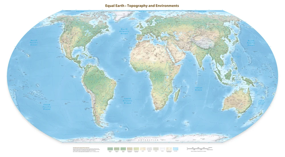
The resolution encourages the use of the Equal Earth projection and other equal-area maps when accurately representing relative landmass is important. Equal-area projections provide a very different visual perspective of Africa’s true scale.
Led by Togo on behalf of the African Group and supported by the African Union, the resolution was adopted by 164 votes in favour, with one against and six abstentions.
The resolution does not ban the Mercator projection or prescribe a single replacement. Instead, it encourages greater awareness of the limitations of different map projections and more accurate representation of the world’s regions.
As a Group with operations and partnerships across West and Central Africa, it is an interesting development in how the scale of the continent is represented and understood around the world.
Read more from the United Nations here
Image: Equal Earth Physical Map